Reduce a layer’s complexity by simplifying its geometry
If your dataset is more geometrically complex (i.e., its features are very detailed and contain many vertices) than what your project requires, you can simplify its geometry in desktop GIS software before sharing it to ArcGIS Online.
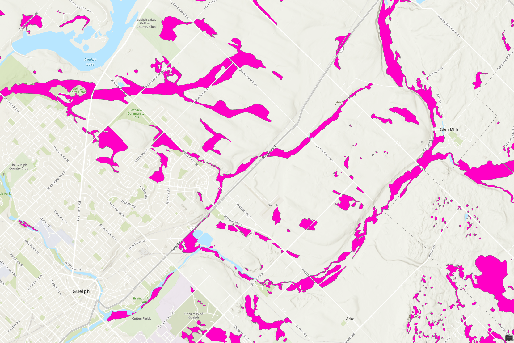
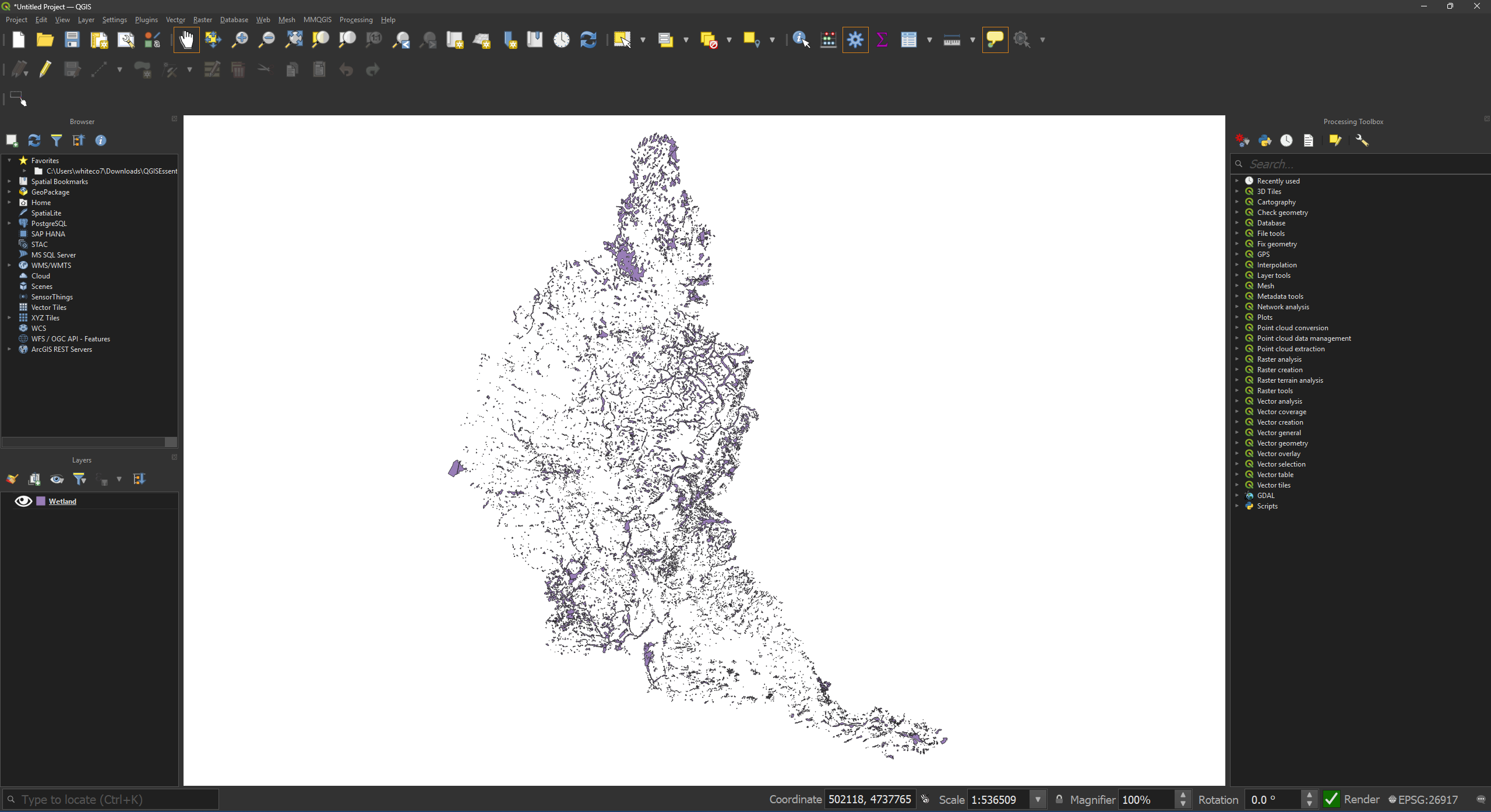
Example: This layer (downloaded from the Grand River Conservation website) shows wetland areas within Ontario’s Grand River watershed. The polygon boundaries have been precisely delineated. If you’re performing an analysis of wetlands where this precision matters, you may need this extra detail. But if that extra precision isn’t needed, you can save space by generalizing the features.
Jump to: ArcGIS Pro instructions | QGIS instructions
Simplifying geometry in ArcGIS Pro
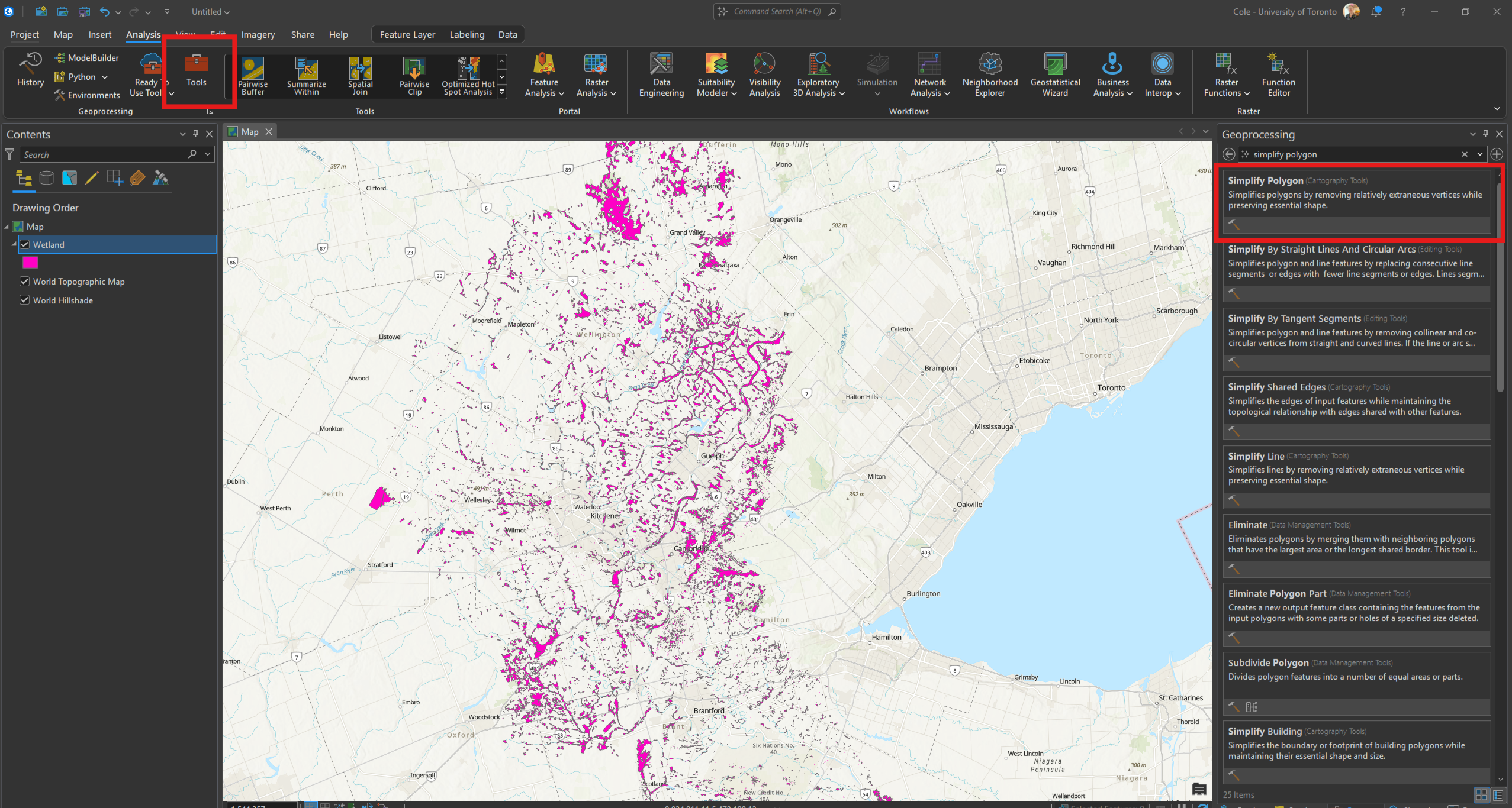
• Open the Simplify Polygon (or Simplify Line if working with a line layer) geoprocessing tool.
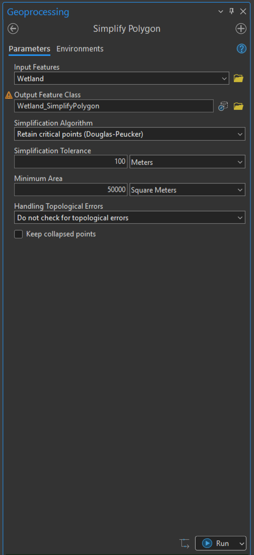
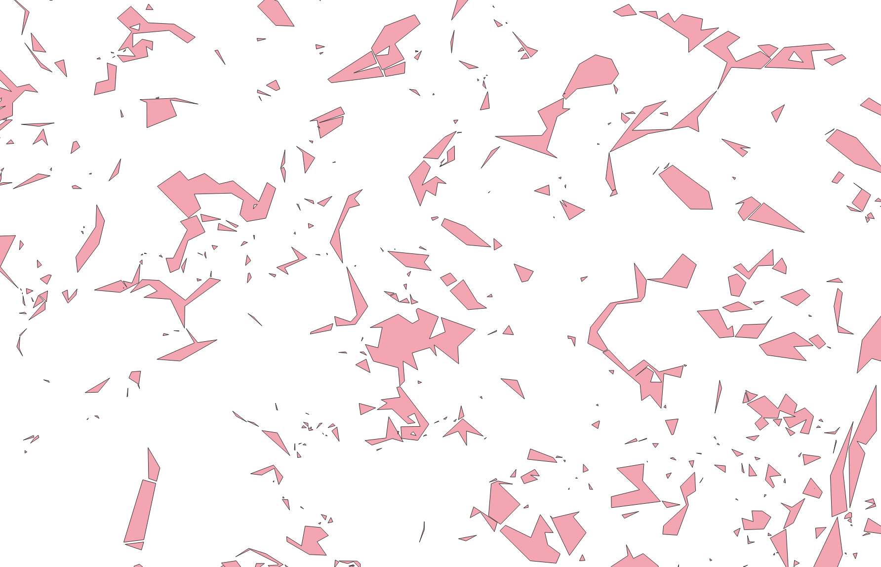
• Specify the layer to be simplified as the Input features. The other parameters will vary based on the nature of your data and your project’s goals. You may want to experiment until you get an output that’s a good trade off between simplifying the layer and retaining the spatial information you need. In this example, critical points are prioritized, features are generalized within a 100-metre tolerance, and features smaller than 50,000m² are removed. Once you’ve specified your parameters, click the Run button.
• The result will be a new layer with simplified geometry. When uploaded to ArcGIS Online, its feature storage usage will be reduced (in this example, the layer’s feature storage usage was reduced by about 85%)!
Before:
After:
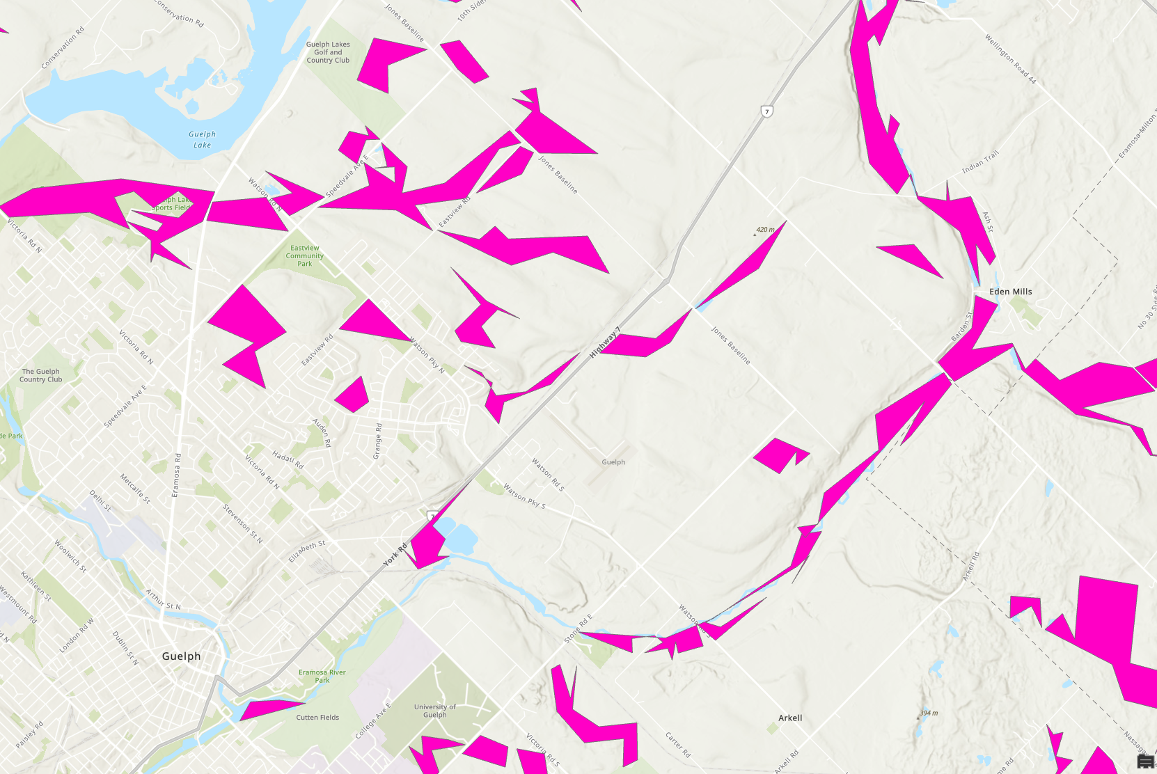
Note: If you would like to retain the curvature of features for cartographic purposes (i.e., you want something that looks nicer than the jagged polygons in the output shown above), select Retain critical bends (Wang-Müller) for the Simplification Algorithm parameter of the tool. This won’t reduce the file size as dramatically, but can still make a big difference.
More information on the Simplify Polygon tool and its parameters are available on its documentation page.
You may also want to try some of the other tools available in ArcGIS Pro’s Generalization toolset. You can learn more about them here.
Simplifying geometry in QGIS
• Open QGIS and load your layer.
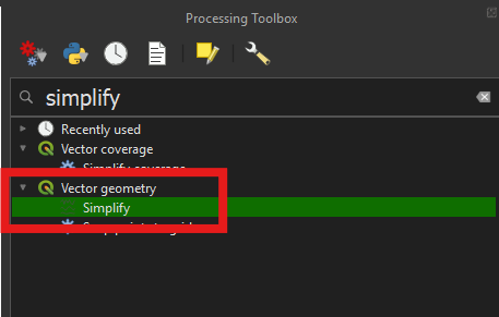
• From the Processing Toolbox open the Vector geometry -> Simplify tool.
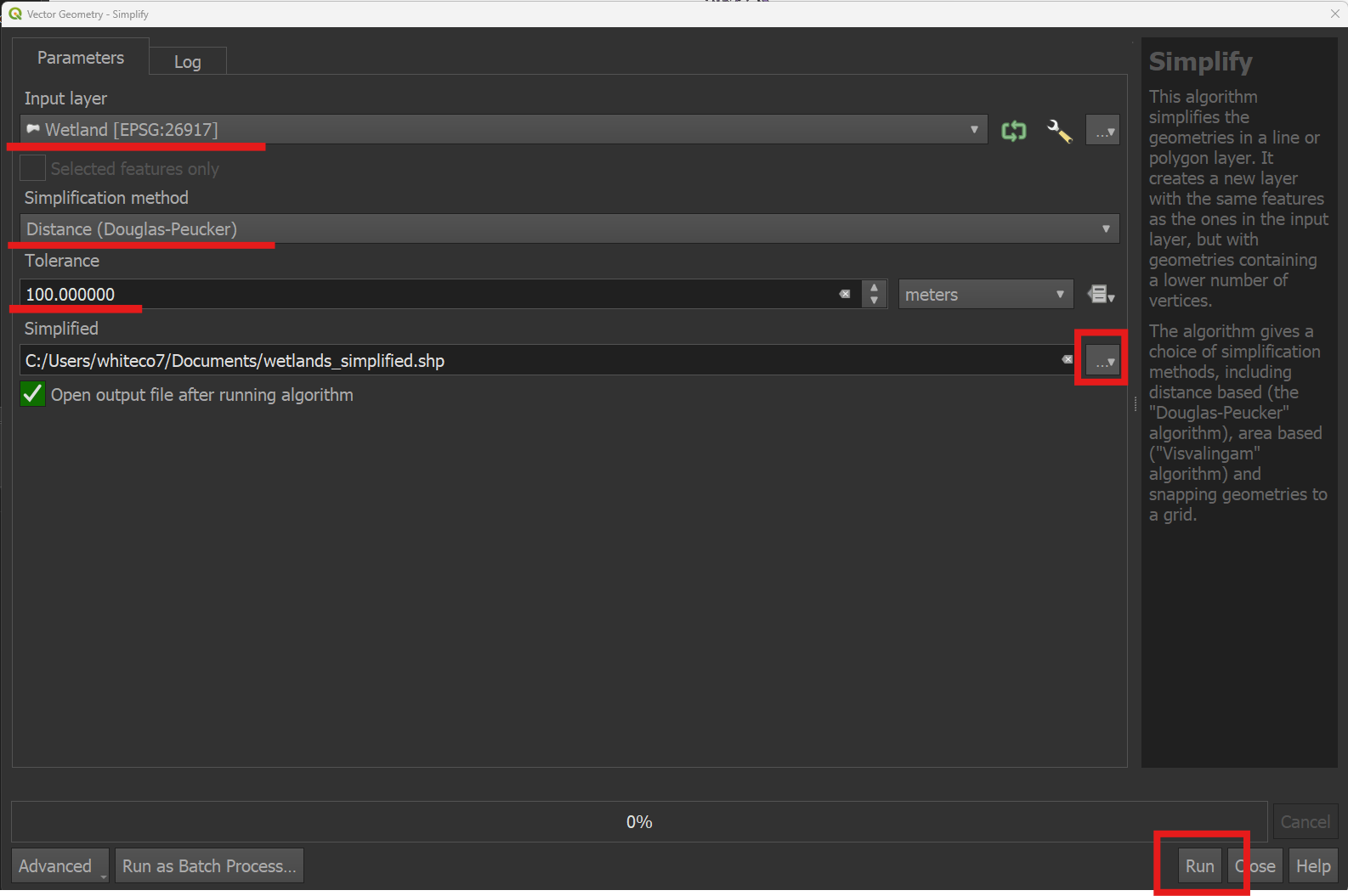
• Select your layer as the Input layer, and save the simplified output to your filesystem as a shapefile. You can experiment with different values for the Simplification method and Tolerance parameters until you arrive at something that’s a good trade-off between reducing the layer’s complexity and retaining the information you need. Click Run.
• The result will be a geometrically simplified layer. When uploaded to ArcGIS Online, it will use less storage space (in this example, feature storage consumption was reduced by 85%).
Before:
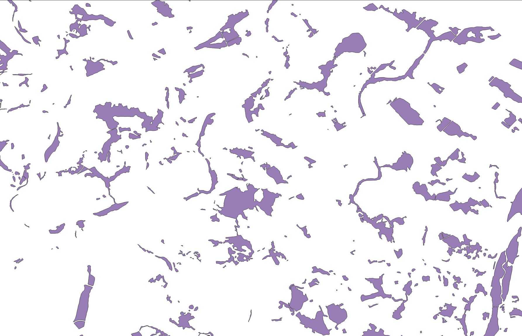
After:
If you’d like to try some simplification tools with more options, we recommend the Geo Simplification plugin for QGIS.
To further simplify your results, you might additionally want to query and delete the smallest features from the layer (see Subsetting data in QGIS).