Managing credits
As with feature storage, we encourage you to use credits thoughtfully. If you’re finding that your work is consuming a lot of credits, here’s a noncomprehensive list of potentially helpful strategies and workarounds.
Use desktop GIS software for geoprocessing
The analysis tools in the ArcGIS Online Map Viewer consume credits. Basic operations on smaller datasets generally use a very small number of credits and pose no issue. However, operations on larger datasets, or workflows that require repeated tool executions, may consume thousands of credits. If you’re performing very intensive analyses, we recommend using ArcGIS Pro or QGIS instead of ArcGIS Online. These desktop applications also have better file management functionality that will be to your benefit when undertaking more complex projects.
Notes on geocoding
Geocoding is the process of converting natural language street addresses to geographic points. It works by applying a matching algorithm between your addresses (or other types of locations, in some cases) and a database of known addresses and their corresponding geographic locations. In GIS, this type of database is often called a locator. A locator may take the form of a cloud-based service that you query for information, or as local data on your computer.
Cloud-based locators are the more convenient option, but often involve a fee (or in the case of ArcGIS, credits), and there may be limitations on how much you can use them. With local options, on the other hand, it can be quite challenging to find and compile comprehensive, up-to-date street and address information. Additionally, the locator files may be quite large, and the geocoding process can take considerable time on less powerful computers.
Geocoding in ArcGIS Pro - using offline locators
Unlike many other geoprocessing operations, just using ArcGIS Pro instead of ArcGIS Online for geocoding isn’t enough to circumvent the credit usage issue. Unless otherwise configured, geocoding in Pro will still query Esri’s cloud-based locator to get geographic information from your addresses. This is the exact same thing that the ArcGIS Online Map Viewer version of the tool does, and it will still eat up credits from your account. Using a local, offline locator can solve this problem. Here are some options for your consideration:
StreetMap Premium: If your study area is within North America, we recommend using Esri’s StreetMap Premium North America as an alternative to their web-based geocoding service. StreetMap Premium is a licensed data product designed to work with ArcGIS Pro, and includes offline locators. If you think StreetMap Premium would be helpful for your work, please contact the Map and Data Library to request a license and a download link.
Open, downloadable locators: Free ArcGIS Pro locators are available from the Open ArcGIS Pro Offline Locators project. These use OpenStreetMap as a spatial backend, are downloadable by region, and are already packaged as ArcGIS Pro-compatible files. However, you may find that these locators are less sophisticated than official or commercial offerings, and that your results may vary by region. (An an example, the United Kingdom locator found locations for about 68% of an official Ordnance Survey dataset of addresses in Inverness, Scotland.)
Create a custom locator: Although it can require significant data preparation, it is possible to create your own locator in ArcGIS Pro. More information about this is available in their documentation.
Alternative web service geocoding options
Outside of Esri’s ecosystem, here are some web-based geocoders you may be interested in:
Nominatim is a free geocoding engine that uses OpenStreetMap data to find locations. You can access it by writing code (in Python, for example), or in QGIS using the MMQGIS plugin. There are, however, some fairly strict API limits in place - it’s not designed for bulk geocoding (see their usage policy here). Additionally, because OpenStreetMap data is crowdsourced, you may find that the accuracy of your geocoding output varies by region.
Alternatively, there are various commercial geocoding services that offer a free tier. You might try Geoapify, OpenCage, or LocationIQ and see if their free versions meet your needs. After signing up for one of these services, you will be able to generate an API key - a password for accessing their data and performing geocoding.
Notes on network analysis
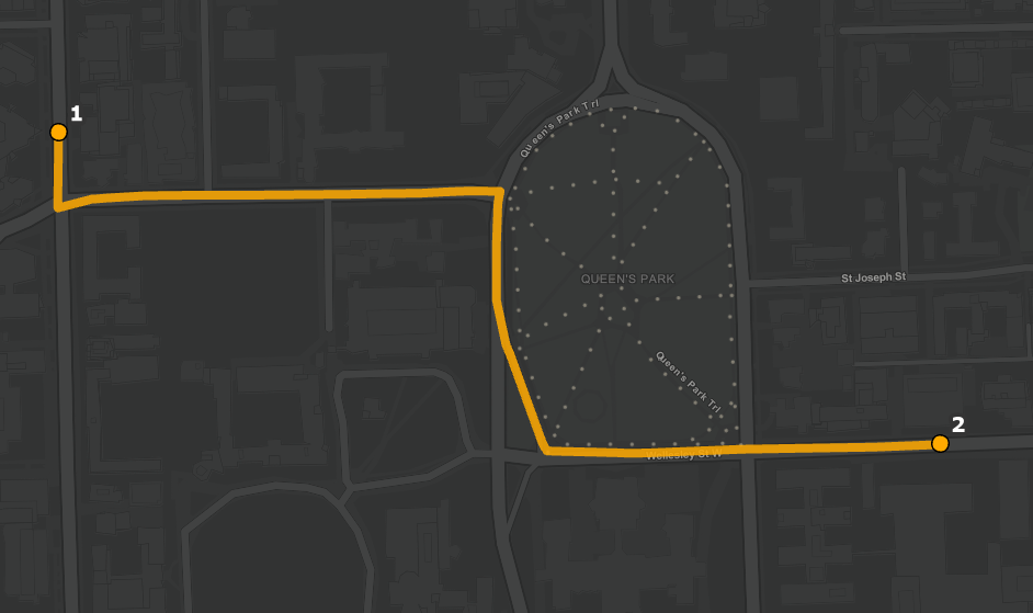
Network analysis in GIS models movement within connected spatial infrastructure - for example, determining the shortest driving route between two or more locations. In ArcGIS Pro, the source of this information can be an online network data source, or an offline network dataset. As with geocoding, an online data source may be more convenient, but will generally come with usage restrictions and costs (credits, in the case of ArcGIS). An offline network dataset is more flexible, but you’ll need to obtain or create the (sometimes quite large and complex) input data.
Smaller analyses will not consume prohibitive amounts of credits. However, if you’re faced with a more intensive task, you may need to find an alternative to Esri’s cloud-based network analysis solver. Here’s a non-comprehensive list of options you might want to try:
If your study area is within North America, we can provide you with offline network datasets from Esri’s StreetMap Premium North America product. Contact the Map and Data Library for more information.
The QNEAT3 plugin for QGIS provides tools for generating shortest paths, origin-destination matrices, service area polygons, and more. You will need, however, to provide a street network layer as an input.
If you are comfortable with Python (or would like to learn), the OSMnx and NetworkX libraries can be used together to perform network analysis using OpenStreetMap data.